Skip to content
Hidden Earth Atlas

Sub-national & rural hidden gems

Lesser-known towns, villages and regional hubs outside the major capitals. 17 so far.

More filters
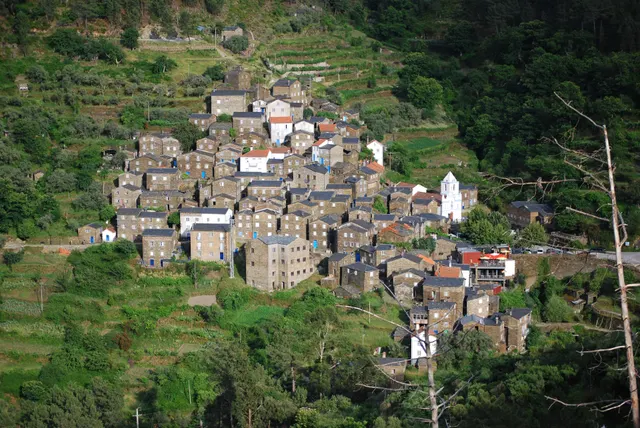
Grey schist houses of Piódão climbing the hillside with the white parish church in the centre
Hidden towns Portugal · Coimbra District

Piódão

A schist village stacked like an amphitheatre into the Serra do Açor, where slate-black houses with blue-painted doors face a single white church.

Coordinates
40°13′47″N 7°49′31″W
Crowds
Quiet
Landscape
Mountain
Best season
Best in Autumn
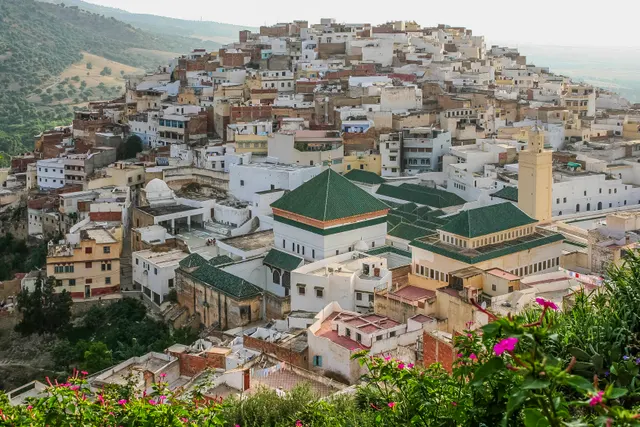
Moulay Idriss Zerhoun, Place in Fès-Meknès, Morocco
Hidden towns Morocco · Fès-Meknès

Moulay Idriss Zerhoun

A white hill-town wrapped around two hills above the Roman ruins of Volubilis, holy to Moroccans and almost unvisited by everyone else.

Coordinates
34°03′19″N 5°31′16″W
Crowds
Quiet
Landscape
Mountain
Best season
Best in Spring
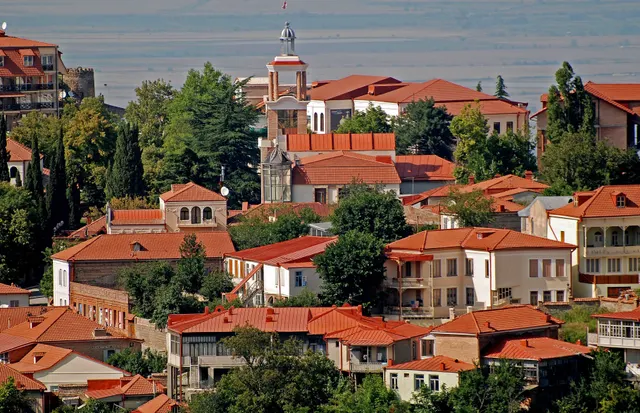
Signagi, Town in Kakheti, Georgia
Hidden towns Georgia · Kakheti

Sighnaghi

An 18th-century walled town on a ridge above the Alazani valley, with the Caucasus as a backdrop and Kakheti's wine villages below.

Coordinates
41°37′10″N 45°55′19″E
Crowds
Some visitors
Landscape
Plateau & highland
Best season
Best in Autumn
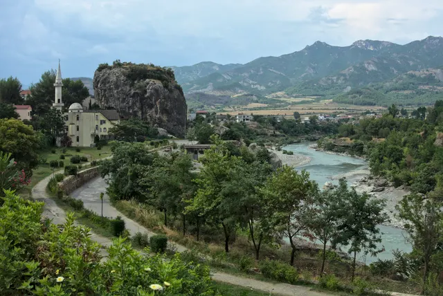
Përmet, City in Albania
Hidden towns Albania · Gjirokastër County

Përmet

A slow town on the Vjosa, Europe's last big wild river, with a limestone outcrop in the middle of town and Ottoman bath springs 15 minutes away.

Coordinates
40°14′09″N 20°21′06″E
Crowds
Usually empty
Landscape
River valley
Best season
Best in Shoulder
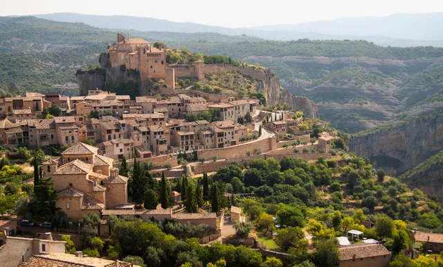
Alquézar, Municipality in Aragon, Spain
Hidden towns Spain · Huesca Province

Alquézar

A medieval village on a limestone spur above the Vero canyon, with walkways bolted to the gorge walls and Palaeolithic rock art in the caves.

Coordinates
42°10′21″N 0°01′15″W
Crowds
Some visitors
Landscape
Gorge & canyon
Best season
Best in Spring
Kuldīga, Town and capital of Kuldīga Municipality, Latvia
Hidden towns Latvia · Kurzeme

Kuldīga

A wooden-and-brick 17th-century town in western Latvia with the widest waterfall in Europe running right through it, listed by UNESCO in 2023 and still overlooked.

Coordinates
56°58′05″N 21°57′41″E
Crowds
Quiet
Landscape
River valley
Best season
Best in Summer
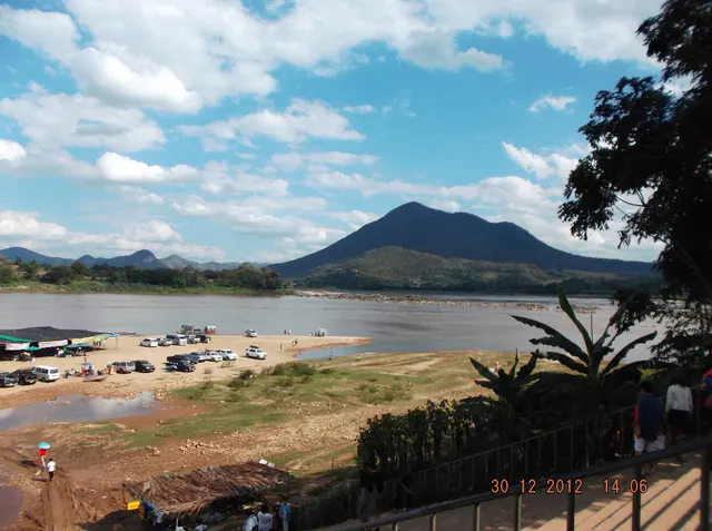
Chiang Khan district, District in Loei, Thailand
Hidden towns Thailand · Loei Province

Chiang Khan

A single street of teak shophouses along the Mekong opposite Laos, where morning alms rounds and river mist are the events of the day.

Coordinates
17°53′51″N 101°39′33″E
Crowds
Some visitors
Landscape
River valley
Best season
Best in Winter
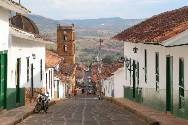
Barichara, Municipality and town in Santander Department, Colombia
Hidden towns Colombia · Santander

Barichara

An 18th-century sandstone town on a plateau above the Suárez canyon, so unchanged it is used as a set whenever Colombian cinema needs the past.

Coordinates
6°38′07″N 73°13′24″W
Crowds
Some visitors
Landscape
Plateau & highland
Best season
Best in Shoulder
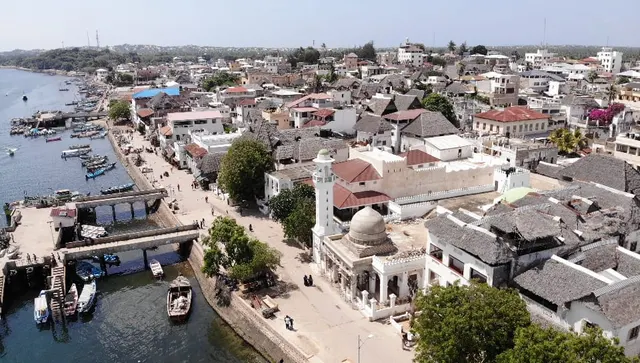
Lamu, Town in Lamu County, Kenya
Hidden towns Kenya · Lamu County

Lamu

The oldest Swahili town on the East African coast, a maze of coral-stone houses and carved doors reached only by boat, with donkeys for traffic.

Coordinates
2°16′18″S 40°54′07″E
Crowds
Quiet
Landscape
Island
Best season
Best in Winter
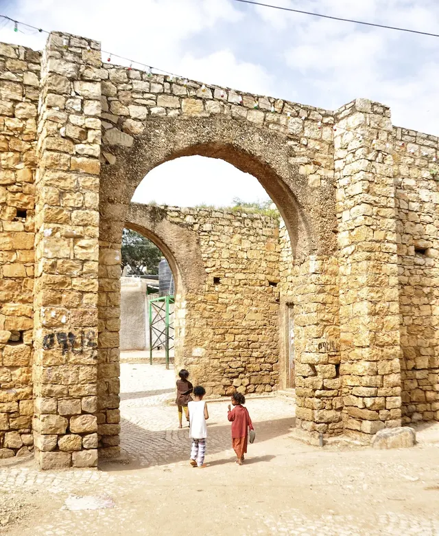
Harar, Capital of Harari Region, Ethiopia
Hidden towns Ethiopia · Harari Region

Harar

A 16th-century walled city of 82 mosques and 360 lanes, where hyenas are hand-fed at the gates every night and the coffee is among the best on Earth.

Coordinates
9°18′40″N 42°07′06″E
Crowds
Quiet
Landscape
Plateau & highland
Best season
Best in Winter
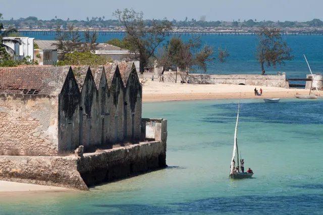
Island of Mozambique, Historically significant island off the northeastern coast of Mozambique
Hidden towns Mozambique · Nampula Province

Ilha de Moçambique

A 3 km coral island that was the capital of Portuguese East Africa for four centuries, its stone town of crumbling mansions and a 16th-century fort now home to fishermen.

Coordinates
15°02′12″S 40°43′60″E
Crowds
Usually empty
Landscape
Island
Best season
Best in Winter
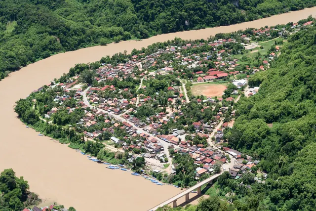
Nong Khiaw, Village in Laos
Hidden towns Laos · Luang Prabang Province

Nong Khiaw

A village on the Nam Ou river hemmed in by limestone karst towers, where the view from the Pha Daeng peak trail takes in the whole valley.

Coordinates
20°34′24″N 102°37′00″E
Crowds
Quiet
Landscape
Gorge & canyon
Best season
Best in Winter